From Milestone to Fingerpost: How Country Routes Found Their Markers
Country route markers turn a ride into a readable landscape, helping you orient yourself while noticing how roads carry traces of their past.
The common mistake with country route markers is to treat them as decoration and ride past without reading them. That costs a useful clue: a milestone or fingerpost can explain where a lane leads, what it once connected and how its role has changed. On a countryside ride, these objects are not merely props beside the road. They are part of its working memory.
Reading the roadside
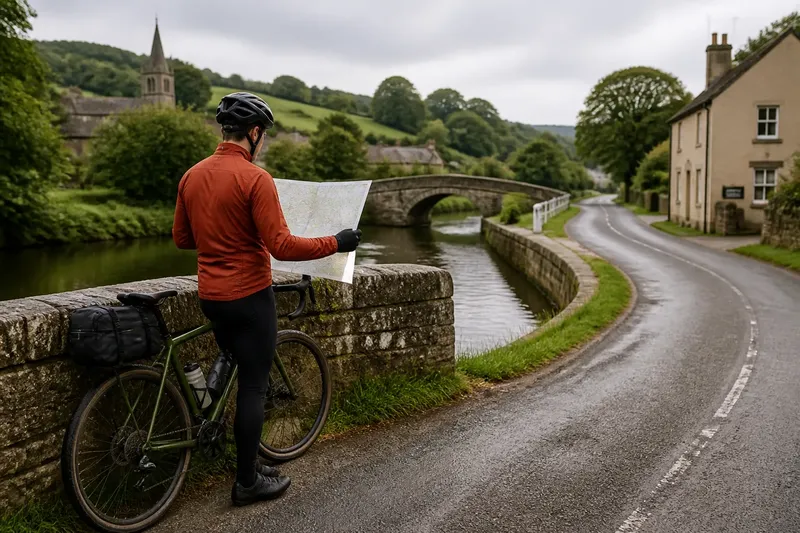
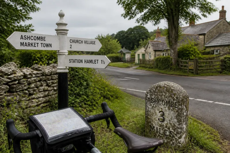
Imagine you are riding through a fictional village called Ashcombe, with a paper map in your bar bag and a fingerpost at a junction. Its arms point towards a market town, a church village and a station hamlet. You use the sign to check your direction, then notice that one destination is no longer shown on the road signs at the next crossroads. The route has become a small investigation: the marker helps with orientation, but also raises a question about what the road used to serve.
That is the useful distinction. A marker can be practical now, historical evidence, or both. A fingerpost gives directional information at a decision point. A milestone usually records distance along a route, often towards a named destination. Neither needs to be old to be useful, and an old object does not automatically describe the road as it works today.
For a cyclist, the best reading combines the marker with the junction, the map and what is visible beyond it. A sign pointing to a village may help confirm a turn; it does not replace checking the route ahead. Names can recur, roads can have changed, and an arrow may refer to a route that is less obvious from the saddle than from a horse or carriage.
What the objects say
Milestones made distance legible. Set beside roads, they could tell travellers how far they had come or how far remained to a destination. Their inscriptions may include a place name, a distance, a maker or an indication of the authority responsible for the road. Weather, repairs and changing conventions can leave some details faint or incomplete.
Fingerposts answer a different question: which way? Their arms make a junction readable without requiring a traveller to consult a map at every turn. Older examples may have cast-iron or timber parts, while newer signs often use standardised materials and lettering. The form varies by locality, and replacement does not necessarily mean the sign has lost all connection with its predecessor.
Other roadside clues belong in the same broad family without being interchangeable. A boundary stone marks an edge, not a destination. A sign to a church or public house may serve local navigation but does not establish the age of the road. Treating every stone or post as a milestone produces confident interpretations from very little evidence.
Following Ashcombe’s clues
At Ashcombe’s junction, the rider checks the fingerpost against the map and chooses the arm towards the station hamlet. The map shows a lane continuing beyond it, while the sign names a destination that the map marks only as a small cluster of buildings. That difference is not a contradiction: maps and signs are made for different purposes and may be updated at different times.
A little farther on, a milestone carries a partly legible place name and a distance. The rider does not assume that the figure measures the modern route from the same point shown on a phone. Instead, the stone is read as an object with its own context: where it stands, which road it faces and what destinations it names. A quick look at the map suggests the place still exists, but the lane now bends around the settlement rather than passing through its centre.
By the ride’s end, the rider has reached the hamlet and found the old station building repurposed. The marker has not supplied a complete history; it has supplied a starting point for noticing change. The practical result is equally modest and worthwhile: at the next junction, the rider has a clearer sense of which way to go, without confusing a historical clue with current route instructions.
Questions at the junction?
What is the difference between a milestone and a fingerpost?
A milestone generally records distance and may name a destination. A fingerpost points towards places or routes, so it is chiefly directional.
Can an old marker still help with navigation?
Yes, as a supporting clue when its destination matches the map and the junction makes sense. Keep using a current map or route plan for turns, since the marker may reflect an older road arrangement.
How can I read a worn inscription?
Look for surviving letters, numbers and place names, but do not fill gaps by guesswork. Compare the visible wording with a map and note uncertainty rather than treating a plausible reading as certain.
May I photograph or touch a roadside marker?
A photograph from a safe place is usually the simplest record. Do not climb onto, scrape or move a marker; access and protection rules depend on the object and location, so check local signs or ask the relevant authority if you need to do more.
Ride with a margin
On a quiet lane, stopping to read a sign still calls for ordinary road sense. Choose a place fully clear of moving traffic, and do not stop where a bend or junction hides you from approaching road users. If there is no safe place to pause, keep riding and consult the map when the road allows it.
For a ride that centres on markers, choose a route with several known junctions or listed roadside landmarks, then leave room for a detour if one is inaccessible. A paper map is handy when a phone signal is weak; a phone can help identify a place name or compare the route with current mapping. Neither needs to turn the outing into a hunt for every surviving stone.
Ashcombe’s invented ride ends with a practical lesson: use country route markers first to understand the road in front of you, then let their names and inscriptions prompt a closer look at the landscape. The most useful object may be a plain, recently replaced fingerpost; the most evocative may be a worn milestone that offers no reliable turn at all. Both make the countryside easier to read, provided you know which question each one can answer.